By Ted Schurter
August 18, 2026
Water is the unlikely analog star of the artificial intelligence boom. Everyone wants it.
It's required in large quantities to produce processors, cool data centers, and often to generate the electricity that animates AI.
The problem is everyone needs it, too. Literally.
As data centers sprout across the country, so does opposition to their use of regional water supplies. These skirmishes about using water for the digital world rather than the biological one are unlikely to be the last.
Water comprises about 50% of Indiana’s borders and the state has a significant amount. But it was unprepared to resolve a water fight in 2023.
The situation pitted the state’s own development district, designed to attract high tech industry like semiconductor manufacturers, against area residents. The issue was a proposed pipeline that would transfer up to 100 million gallons of water a day 40 miles to the district.
The state didn't have the data necessary to comprehensively analyze the impact on regional water supplies and and the pipeline was paused.
Conflict has also followed the subsequent wave of data center development across the state. A lack of statewide data or updated regulations has left many residents uncertain and angry about the impact of such large-scale water users on their regional supplies.
In 2025 Indiana Gov. Mike Braun ordered an inventory and management plan of the state’s water, due by the end of 2026. In the interim many data center developments have already moved forward.
While the water inventory should provide clarity on the state's supplies it won’t change the underlying reality that both the biological world and the digital world need water to thrive.
Digital deluge
Like electrification before it, the growth of home internet access across the US, especially in rural areas, has been uneven but steady. When Google was officially launched in 1998, 74% of US households did not have home internet access according to the National Telecommunications and Information Administration (NTIA)’s annual Internet Use Survey.
Twenty-five years later in 2023, the most recent year NTIA’s data is available, households connected to the internet by landline, cellular or satellite had become the norm, constituting 85% of US households; 77% had a mobile data plan.

Once a place to check if ‘you’ve got mail’, the internet has become a complex digital world where modern life is mediated.
Education, healthcare, personal finance, relationships and more can be navigated partially or wholly in the digital world. It’s also home to an endless store of photos, videos, and more recently, artificially intelligent assistants.
The high-tech companies that manifest this digital world are inescapable institutions, as likely to be found among our phone apps as our retirement account investments.
Brands like Alphabet, Amazon and Meta provide ubiquitous services while others, like Intel and Nvidia produce physical components that enable them. They drive productivity and markets.
As more of our lives shift to the digital world its physical footprint grows. Despite the ecological monikers, the infrastructure underlying technologies like cloud computing and data streams are undeniably industrial, noisy, thirsty and power-hungry.
They’re also expensive.
Recognizing the economic and national security advantages to onshoring production of semiconductors and other high-tech manufacturing, Congress authorized $50 billion to support domestic semiconductor manufacturing and research through the federal CHIPS and Science Act of 2022.
Even more money is pouring in from high tech companies themselves as they build new centers to handle AI's increased storage and processing needs.

In places where these new factories and facilities are proposed or built, this growth reveals a tension between the digital world and our biological one: we both depend on water for survival.
Digital data’s creation, computation, storage and access is made possible by components whose manufacturing and operation, especially when concentrated into high density facilities, require quantities of water measured in millions of gallons a day.
Though it’s unevenly distributed, Indiana's ample water is an asset as it competes with other states to secure the high-tech investments that support the digital world.
Today’s fights over who controls and profits from access to the state’s water are not new.
A wealth of water
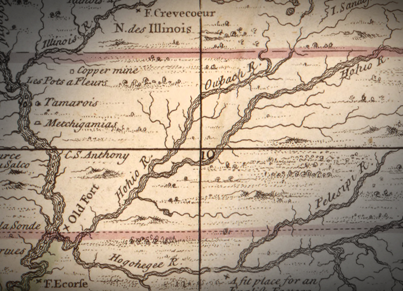
The epic glaciers that repeatedly scoured, buried, and flooded the landscape of northern North America endowed the area that would become Indiana with abundant water resources.
The area’s lakes, rivers and streams eased travel and trade for Indiana’s Indigenous people and the French trappers and traders who arrived in the early 1700s looking for furs and new paths through unfamiliar land.
The state’s largest rivers, the Ohio and Wabash Rivers, indirectly connected New France’s northern and southern territories via the St. Lawrence and Mississippi Rivers. Voyageurs, men who piloted long, cargo-laden canoes through waterways, and carried them across land when necessary, transported European goods from the St. Lawrence River Valley in present-day Canada deeper, and deeper into New France along these routes.
Forts and trading posts emerged along the rivers to support those efforts, including Fort St-Philippe des Miamis, located near the confluence of the St. Marys and St. Joseph Rivers in Fort Wayne, Ind., the Cicott trading post northeast of Attica, Ind., and Poste de Vincennes, which grew into the town of Vincennes, Ind.

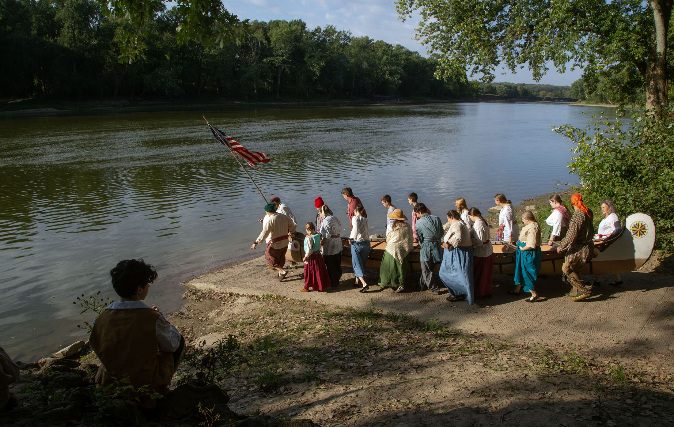
Roughly four miles west of Lafayette, Ind., about 80 yards behind the tree line on the north bank of the Wabash River is a replica of Fort Ouiatenon, pronounced wee-ah-teh-non, the region’s first French outpost. It was situated across the river from the established Wea village of Ouiatenon.
While it facilitated the fur trade, the fort also fostered relationships with the Wea and other area tribes and allowed the French to control the river. At its peak, it housed around 20 soldiers and a dozen traders in 14 structures, including a blacksmith shop and a chapel. The prosperous trade swelled the surrounding Indigenous population into the thousands.
Through the course of conflicts and wars, control of the fort changed hands among the French, British, American and Indigenous tribes. By the late 1700s it was used to stage attacks against American settlers. In 1791 it was burned down and the local Indigenous people were forced out or killed.
The fort was important, but it was the Wabash River, known as the waapaahshiiki siipiiwi, or “White Shining River,” in the Algonquian tongue of the Miami and Illinois tribes, that was the more enduring asset.
More than 300 years later, the same stretch of the Wabash became ground zero in another fight about who controls the region’s water.
Problematic pipeline
After losing out for a multi-billion-dollar semiconductor chip manufacturing plant that landed next door in Ohio, the Indiana Economic Development Corporation, a quasi-private, state-funded organization, quietly began acquiring property in late 2022 for what would become the Limitless Exploration/Advanced Pace (LEAP) Innovation District in Boone County.
Wabash River
Lafayette/
West Lafayette
Proposed LEAP pipeline
Purchased LEAP
property
Lebanon
69
65
74
Indianapolis
70
69
65
10 mi
Map area
Wabash River
Lafayette/
West Lafayette
Proposed LEAP pipeline
Purchased LEAP
property
Lebanon
69
65
74
Indianapolis
70
69
65
10 mi
Map area
Wabash River
Lafayette/
West Lafayette
Proposed LEAP pipeline
Purchased LEAP
property
Lebanon
69
65
74
Indianapolis
70
69
65
10 mi
Map area
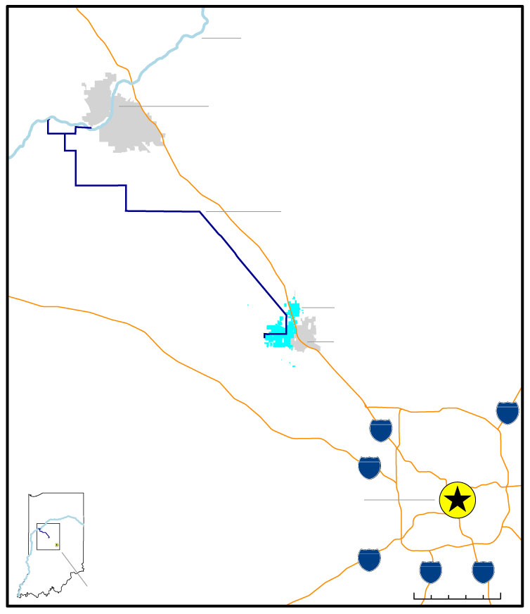
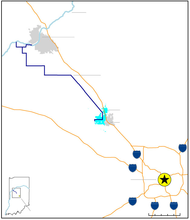
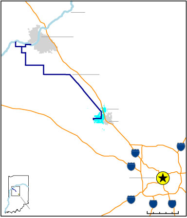
They spent more than a billion dollars purchasing and preparing a site strategically situated between Purdue University, a top-tier research institution in West Lafayette, Ind., and Indianapolis. It is proximate to multiple interstates, a well-educated workforce and the state’s cultural center. But it lacks sufficient water, an important ingredient for the kind of high-tech development it hopes to attract.
To solve that problem, the IEDC proposed sinking two high-capacity radial wells along the Wabash River east and west of Fort Ouiatenon’s location. They would collectively withdraw up to 100 million gallons of water daily from the aquifer connected to the river and pump it 40 miles to the district.
The 2023 plan aroused immediate and successful local opposition that prompted then Indiana Gov. Eric Holcomb to order the completion of two regional water studies to assess the area’s current and future water demands and supplies.
Fourteen months after Holcomb’s order, Gov. Mike Braun, his successor, ordered a similar statewide water inventory be completed by the end of 2026. He also signed Senate Bill 4 into law that outlined new requirements for transferring large amounts of water out of a state water basin, as the proposed pipeline would have done.
Braun’s actions occurred in an atmosphere transformed by water-related debates ignited by the controversial LEAP district and its pipeline.
Opposition to the proposed water transfer foreshadowed today’s resistance across the state to the growing number of large-scale data centers proposed in the past few years. These facilities, necessary to meet the demands of AI products, require large amounts of water for cooling and for the energy production required to satisfy their significant power needs.
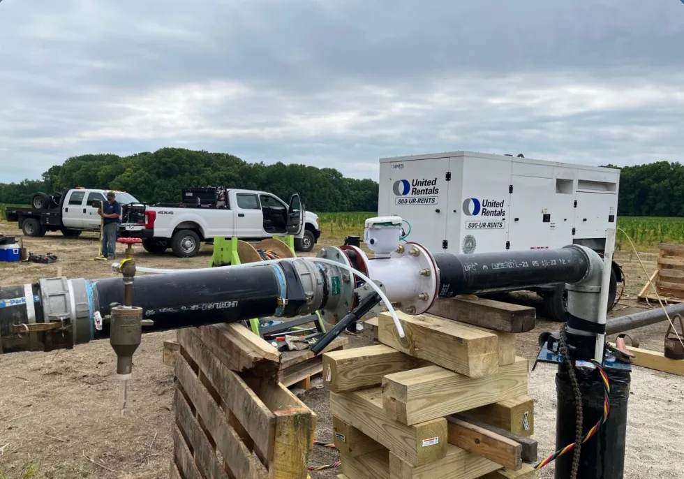
Though the pipeline was paused, perhaps indefinitely, and the LEAP District eventually sourced enough water for its current occupants, difficult questions remain about how the state will balance the needs of the thirsty high-tech industries it is trying to attract with the water needs and rights of its existing businesses, ecosystems, and residents.
For example, whether the state’s current requirements for significant water withdrawals are sufficient to safeguard the state’s water resources. What improvements are needed to better measure and monitor the state’s naturally fluctuating water levels? What is an appropriate state role in regulating water use?
When considering potential water use regulation, it is easy to assume, for example, that policy should prioritize feeding people over feeding social media and therefore agricultural use would supersede industrial use. But the degree to which the digital world is enmeshed in everyday existence makes weighing the competing uses more difficult than it seems.
Indiana is unlikely to be confronted with a binary choice between using water to support the biological world or the digital world. But its water is not evenly distributed, and choices will need to be made regarding where, how many and what kind of high-capacity water users any region can support while preserving the resource for current and future generations.
Learning more
The dynamics influencing water availability are simultaneously contemporary and historic, local and global, natural and manmade. Their interplay complicates efforts to casually determine whether a given region has enough water to support a specific activity.
The IFA has published several regional studies to inform policymakers and others about the quality and quantity of the state’s water resources. They encompass the complexity of calculating water availability and though they don’t yet cover the entire state, they are useful guides for understanding the variables involved.
The following pages elaborate further on the recent IFA water studies and, as background, some fundamental topics about water.
- Global distribution of water reviews the distribution of freshwater versus non-freshwater, the differences between ground and surface water, and the organization of surface water resources into distinct geographic boundaries.
- The hydrologic cycle visualizes the interaction of groundwater and surface water within the larger environment.
- Water studies walks through how the IFA's most recent studies determine cumulative excess water availability, the metric used to determine whether a region has enough water to support current demand.